Apple Planning To Include Transit Directions In IOS 9 Maps App

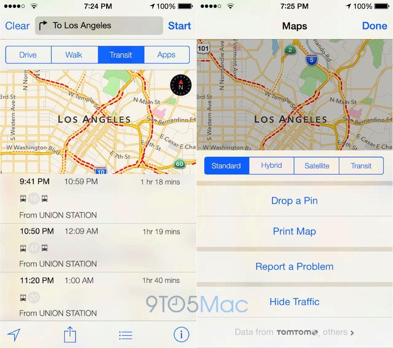
Apple is readying a new Transit feature for its Maps application in iOS 9, according to a new report by 9to5Mac. Apple was rumored to be prepping the feature last year, ahead of iOS 8, but pulled Transit support before launch. In iOS 9, Maps is said to contain support for bus, subway and train routing and will use an interface similar to the one above.
The Transit directions service would allow iPhone users to navigate mass transit via the official Apple Maps application for the first time since Apple removed Google as iOS’s official provider of map data. Sources said last year that the transit functionality for Maps includes larger icons for users to more quickly spot airports, subway stations, and train stations within the Maps app. In addition to the main functionality, there is also a trip planning feature for transit, and a new Transit view alongside the existing Standard, Hybrid, and Satellite/Flyover views.
Very late into development of Transit, Apple reportedly decided against including the feature in iOS 8 due to personnel changes, data inconsistencies and coverage of only a few of Apple’s major markets.
Since that time, Apple is said to have refined its data, added new cities and developed “a new push notifications system that will notify users as new cities gain support”.
New hires and the LinkedIn profile of at least one Apple employee point to the expansion of Apple’s routing team in recent years. This year’s WWDC could be where we se the fruits of that team’s labor.
Apple has also made progress on its indoor mapping project which will enable users to better navigate major buildings, offices and landmarks.
The feature may not go live this year, but sources inform 9to5Mac that Apple is already mapping out its own offices in Cupertino using “autonomous robots with iBeacon sensors” to collect data. Apple also bought indoor mapping company WifiSLAM as well as a number of other mapping-related companies in recent years.
